Leveraging AI and Social Media for Proactive Safety Assessment in Historic Urban Landscapes
In the dynamic field of cultural heritage management, comprehending the public’s interactions and perceptions of historic urban spaces has become paramount. The UNESCO 2011 Recommendation on the Historic Urban Landscape (HUL) advocates for an inclusive approach, integrating “bottom-up” perspectives from local residents and visiting tourists. However, the systematic gathering and interpretation of substantial user-generated data, particularly concerning critical aspects such as safety and accessibility, presents a challenge. A recent exploratory case study conducted in Testaccio, Rome, presents a compelling methodology that synergistically combines artificial intelligence (AI) with social media data. This methodology facilitates the enhancement of safety assessments for buildings and urban areas, thereby opening novel avenues for improvement.

Mapping Public Perception with AI: The Core Methodology
The study, titled “Mapping Urban Heritage Images with Social Media Data and Artificial Intelligence: A Case Study in Testaccio, Rome,” was authored by N. Bai, M. Ducci, R. Mirzikashvili, P. Nourian, and A. Pereira Roders. The study utilised thousands of user-generated posts from Flickr, an image-sharing platform, to analyse images, comments, and geo-locations within the Testaccio area. Given the substantial volume of this unstructured data, artificial intelligence (AI) tools were deemed essential for the analysis. Here is a concise summary of the technical approach employed:
- Image Analysis: Pre-trained deep learning models, such as VGG-16, were employed to process images, extracting structured “visual features.” Subsequently, these features were reduced in dimensionality using Principal Component Analysis (PCA) and t-SNE, resulting in a two-dimensional representation. This representation facilitates the clustering of visually similar images, enabling the identification of dominant visual elements and topics depicted by users.
- Textual Analysis (NLP): English and Italian textual descriptions from posts were translated (if Italian) and subsequently fed into state-of-the-art Natural Language Processing (NLP) models, including BERT and ULMFiT. These models, pre-trained on UNESCO World Heritage Statements of Outstanding Universal Value (OUV), classify sentences based on their relevance to OUV criteria, thereby indicating perceived heritage values. Additionally, word clouds were generated to highlight frequently used terms associated with these values.
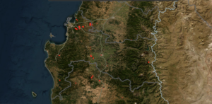
- Geographical Distribution: All collected posts were mapped using Geographic Information Systems (GIS), resulting in heatmaps that visually display areas of high public activity.
This multi-modal analysis allowed researchers to map “perceived and narrated urban heritage images,” offering an alternative view of urban heritage attributes as a collection of depicted and posted content.
Unveiling Safety Insights from User-Generated Data
While the study’s primary focus was on mapping urban heritage images, its findings and methodology hold significant implications for safety assessment:
- Identifying Areas of Low Perception/Engagement as Potential Concerns: The analysis revealed areas that, despite their official heritage status, received little attention or visual representation in Flickr posts, such as Monte Testaccio, the Aurelian Wall, and the Tiber River. This absence of significant visual content was not merely a data anomaly; it suggested deeper issues. Further on-site observations confirmed that reasons for this lack of public engagement included problems with physical accessibility, visibility, and, crucially, a “sense of safety”. This demonstrates that if the public is not actively engaging with or documenting certain spaces, it could be an indirect indicator of underlying safety or accessibility barriers.
- Confirming Safety and Connectivity Issues Through Integrated Analysis: The power of this methodology lies in its integration with other primary data sources like interviews with local stakeholders, direct observations, and field surveys. This integrated approach confirmed critical issues directly relevant to safety assessment:
- Lack of connectivity throughout the neighborhood due to physical barriers like walls and fences.Lack of safety, security, and connectivity along the banks of the Tiber River, with very limited access points.Lack of access to specific heritage sites, such as Monte Testaccio, which is often closed to the public.
- Highlighting “Unexpected Hotspots” and Areas for Requalification: The study also identified “unexpected” significant hotspots on Flickr that weren’t initially marked as official attractions, such as the Testaccio market area and street art near Porto Fluviale. While some were due to single-user activity (e.g., nightlife), others, like the prevalence of street art and graffiti, emerged as “typical characteristics” representing modern urban images. The integrated analysis further confirmed a “thriving street art culture” being used to “requalify derelict and/or abandoned buildings and physical barriers”. This suggests that user-generated content can identify areas that may have previously presented safety risks (due to abandonment or dereliction) and are now undergoing transformation, potentially towards safer, more vibrant spaces. Moreover, safety assessments should also account for the unique vulnerabilities of persons with disabilities, ensuring that risk mitigation strategies, emergency protocols, and communication systems are fully inclusive.
Proactive Planning for Safer Heritage Spaces
The insights gained from this methodology are not just diagnostic; they are prescriptive for urban planning and heritage management, particularly in addressing safety:
- Targeted Interventions: The identification of areas with poor accessibility, visibility, or perceived safety allows for tailored planning suggestions. For instance, interventions focusing on improving access to the Tiber River or Monte Testaccio could be prioritized to enhance public safety and engagement.
- Community-Led Safety Improvements: The methodology aligns with participatory planning processes by identifying what the public values and where they experience challenges. This bottom-up perspective can inform initiatives like a “street museum” using street art to transform physical barriers into communal spaces, fostering a sense of ownership and potentially improving safety through increased activity and community care. Cleaning-up campaigns and installing recreational facilities along riverbanks, led by the local community, can also make these areas safer and more actively used.
- Iterative Monitoring for Long-Term Safety: The proposed methodology suggests an “abductive and iterative system” with a data-driven feedback mechanism. By continuously collecting and analyzing freshly added posts, planners can observe how interventions (e.g., those designed to improve safety or accessibility) gradually alter both physical spaces and their “digital twin”. This allows for ongoing assessment of the impact of safety initiatives and adaptation of strategies over time.
Important Considerations for Implementation
It’s crucial to acknowledge that relying solely on social media data has limitations. The digital divide means that not all demographics are equally represented on these platforms, potentially leading to biases. Therefore, this AI-aided social media analysis should always be integrated with a mixed-methods approach, combining qualitative and quantitative knowledge from interviews, surveys, observations, and participatory workshops to ensure comprehensive and equitable safety assessments.
Conclusion
The application of AI to user-generated social media data provides a powerful and innovative tool for understanding the public’s perception of urban heritage. More importantly, it offers a novel way to diagnose and address safety and accessibility issues within historic urban landscapes. By integrating these digital insights with traditional field research and fostering community participation, cultural heritage professionals can move towards more inclusive, responsive, and ultimately safer management of our invaluable urban heritage.