Monitoring and Maintenance of Archaeological Sites: the Conference Proceedings
The papers collected in the volume are focused on climate change, hydrogeological instability and chemical-environmental degradation
Updated January 2026
Introduction
Historic buildings and archaeological sites are by their nature subject to the degradation that time and atmospheric agents entail. To limit the damage that degradation causes to heritage artefacts, the first requirement is the periodic or, better, continuous control of their state of conservation. The technologies available for this purpose are constantly evolving. This aspect, which is objectively positive, however, poses to professionals and managers of cultural heritage the problem of orienting themselves among the different choices to be adopted.
Even leaving out the problem of choosing between specific sensor technologies, the choice of the design philosophy to follow to collect the data and make them available for management functions, design of restoration interventions, and support for emergency activities is one of the most tricky aspects of the job. The occasions in which to discuss this topic are quite rare, and therefore the publication of conference proceedings that deal with this topic is of particular interest.
The 2019 Rome Conference: A Milestone in Archaeological Site Management
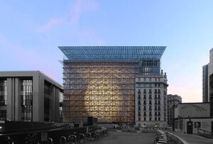
On March 20-21, 2019, a landmark conference titled “Manutenzione e monitoraggio delle aree archeologiche” (Monitoring and Maintenance of Archaeological Sites) was held in Rome at the historic Curia Julia building in the Archaeological Park of Palatine. The conference brought together representatives of institutions active in the experimentation of new methods of conservation to discuss the challenges of the new millennium: reducing vulnerability and increasing resilience through the use of low-impact technologies.
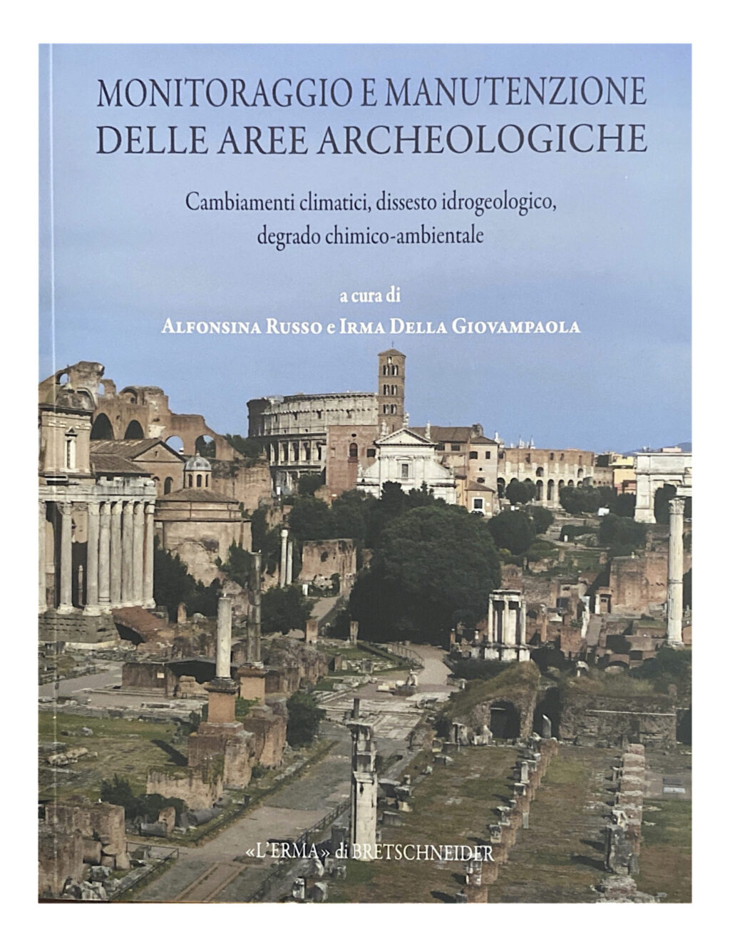
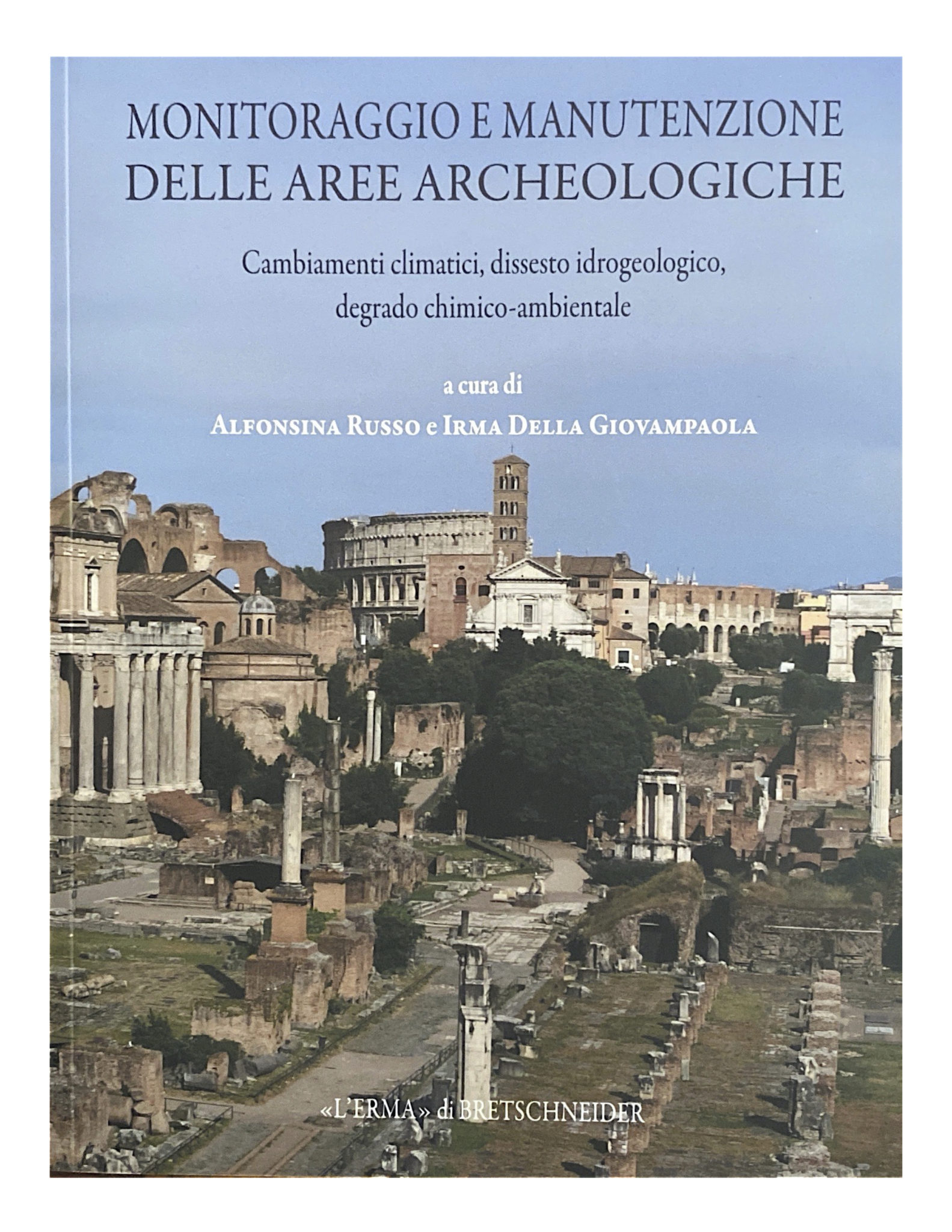
Image Attribution: Cover of the proceedings “Manutenzione e monitoraggio delle aree archeologiche” (Monitoring and Maintenance of Archaeological Sites), edited by Alfonsina Russo and Irma della Giovampaola, Rome 2019. Source: Archaeological Park of the Colosseum (Parco archeologico del Colosseo) / Lerma Publishing. Used for educational and research purposes.
The contents of the volume, edited by Alfonsina Russo and Irma della Giovampaola, concern a large number of aspects of safety, not only of archaeological assets but of historical buildings in general. The Archaeological Park of the Colosseum, which organized the conference, considered multidisciplinarity a fundamental resource in preserving Cultural Heritage. The proceedings “present representatives of institutions active in the experimentation of new methods of conservation to discuss the challenges of the new millennium: reducing vulnerability and increasing resilience through the use of low-impact technologies”.
Conference Structure and Key Themes
The papers collected in the volume are focused on climate change, hydrogeological instability, and chemical-environmental degradation. They are almost all in Italian, with abstracts in English, and provide an interesting insight into the variety of safety aspects that site managers must take care of. The proceedings are divided according to the following structure:
- Session 1: Monitoring in National Parks
The first session concerned monitoring strategies applicable at the national park scale, addressing the unique challenges of managing archaeological sites within larger protected natural areas. - Session 2: International Experiences in Heritage Monitoring
This session exposed international case studies and best practices in cultural heritage monitoring, providing comparative perspectives from different countries and contexts. - Session 3: Italian Monitoring Experiences
The third session focused specifically on Italian approaches to heritage monitoring, showcasing domestic innovations and lessons learned. - Session 4: The Search for a Monitoring Method
This critical session addressed the essential issue of developing standardized, replicable monitoring methodologies that can be adapted to different site conditions and management requirements. - Session 5: Case Studies (13 presentations)
Thirteen individual interventions regarded specific case studies, providing detailed examinations of monitoring implementations at actual heritage sites.
The Multidisciplinary Approach to Archaeological Site Protection
The volume illustrates various case studies in which satellite control of archaeological areas or monumental complexes was used to allow managers to design interventions to be carried out more accurately. The sensors discussed are not limited to satellites but relate to:
- Remotely piloted aerial systems (drones/UAVs)
- LiDAR technologies for deformation control
- Temperature monitoring systems
- Micro-stress sensors on structures
Alongside the problems to be solved, the volume highlights the speed with which technological solutions improve the ability to understand phenomena potentially dangerous for assets and the possibility of timely intervention. The list of individual themes covers different aspects, from the interaction between plants and underground artefacts to the effects of the sea or atmospheric agents on buildings.[fireriskheritage]
The use of laser scanners has been prescribed for both survey activities in ordinary conditions and for the needs of emergency intervention on historic buildings after a seismic event. Cases are dealt with that go far beyond just archaeological systems: from monitoring on an urban scale to national parks, while the risks treated concern practically all those of natural origin, from earthquakes to hydrogeological events. The underlying theme can be summarized with the title of one paper concerning the Machu Picchu site, which translates as “Between Knowledge and Management”.
Fire Risk in Archaeological Sites: An Often-Overlooked Threat
While the conference proceedings focused primarily on structural degradation, climate change, and hydrogeological risks, fire represents a critical but often underestimated threat to archaeological sites. Understanding and mitigating fire risk is essential for comprehensive site protection.
Unique Fire Vulnerabilities of Archaeological Sites
Archaeological sites present distinct fire risk profiles compared to standing historic buildings:
Vegetation Fire Risk
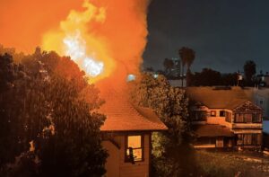
Archaeological sites, often located in natural landscapes, face significant wildfire threats. The August 2025 fire on Mount Vesuvius demonstrated this risk when the Archaeological Park of Pompeii had to coordinate closely with local authorities to monitor potential impacts, though the sites of Boscoreale and Pompeii remained open. Climate change is increasing wildfire frequency and intensity, with Mediterranean archaeological sites particularly vulnerable.
Visitor-Related Fire Hazards
Pompeii’s visitor regulations explicitly prohibit lighting fires, throwing lit cigarettes, or otherwise behaving in ways that may create a fire hazard. With millions of annual visitors to major archaeological sites, human-caused ignition sources represent an ongoing management challenge. The density of visitors during peak seasons amplifies this risk.
Structural Vulnerabilities
Many archaeological sites include reconstructed or partially restored wooden elements (roof structures, shelters, walkways) that introduce combustible materials into otherwise non-combustible stone or masonry ruins. Climate change is exacerbating structural vulnerabilities at sites like Pompeii, where rising sea levels, intense rainfall, and extreme temperatures threaten preservation. Studies predict erosion risk could increase by up to 16% by 2100, potentially creating more exposed, fire-vulnerable structures.
Lack of Active Fire Protection
Unlike museum buildings or occupied historic structures, archaeological sites typically lack:
- Fire detection and alarm systems
- Suppression systems (sprinklers, standpipes)
- Compartmentation to prevent fire spread
- 24-hour monitoring or security presence
- Nearby firefighting water sources
This absence of active protection means archaeological sites must rely entirely on passive measures, early detection through surveillance, and rapid response.
Historical Fire Incidents at Archaeological Sites
Fire has historically posed threats to archaeological sites:
- Ancient Pompeii itself shows evidence of fire risk management: the Curia (Council meeting-house) was designed to avoid fire risk, and ancient Romans used fast food establishments (thermopolia) partly because tenants in multi-story buildings faced cooking fire risks
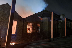
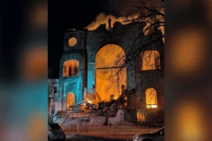
- Modern protective structures at archaeological sites have experienced fire damage, destroying interpretive facilities, visitor centers, and conservation laboratories
- Vegetation fires have repeatedly threatened sites including Pompeii-Herculaneum, Greek archaeological sites, and Middle Eastern heritage areas
Fire Risk Management Strategies for Archaeological Sites
Effective fire protection for archaeological sites requires adapted strategies:
Vegetation Management
- Creating defensible space around significant structures and features
- Regular removal of dry vegetation and accumulated combustible debris
- Strategic planting of fire-resistant species
- Establishment of fuel breaks to prevent fire spread
Early Warning and Detection
- Integration of fire detection into general site monitoring systems
- Drone-based thermal imaging for hot spot detection
- Satellite-based fire risk mapping and early warning systems
- Collaboration with local fire services for rapid notification
Emergency Response Planning
- Pre-planning with fire services for site access, water sources, and priority protection areas
- Identification of movable artifacts requiring emergency evacuation
- Establishment of on-site firefighting equipment caches (extinguishers, tools)
- Training of site personnel in basic firefighting and emergency procedures
Visitor Management
- Strict enforcement of no-smoking and no-fire regulations
- Designated safe areas for any necessary fire use (cooking facilities for staff)
- Education programs highlighting fire risks and visitor responsibilities
- Increased surveillance during high-risk fire weather conditions
Monitoring Technology Overview: Tools for Comprehensive Site Protection
Modern archaeological site monitoring employs a diverse array of technologies, each offering unique capabilities for detecting degradation, assessing risks, and planning interventions.
Unmanned Aerial Vehicles (UAVs) / Drones
UAV archaeology (or drone archaeology) is the scientific application of Unmanned Aerial Systems (UAS) to detect, map, and monitor cultural heritage. Drones have become transformative tools for archaeological site management.
Primary Applications:
- Enhanced Surveillance and Monitoring: Regular coverage of large or remote heritage sites, identifying changes in landscape, structural integrity, or signs of intrusion
- High-Resolution Documentation: Capturing detailed imagery of features like high-level wall tops and roof conditions
- Security and Deterrence: Monitoring for illicit activities such as illegal logging, mining, poaching, or trespassing
- Rapid Response: Post-disaster damage assessment without risking human lives
Specific Capabilities:
- Photogrammetry: Creating highly accurate 3D models from overlapping photographs
- Topographical Mapping: Generating digital surface models (DSMs) and digital elevation models (DEMs)[
- Thermal Imaging: Detecting subsurface features, moisture problems, or fire hot spots
- Time-Series Documentation: At the Zagora Archaeological Project (Greece), drones are flown daily to record open trenches, developing a 4D record (3D space plus time) that allows archaeologists to digitally “unravel” the excavation process[
Cost Considerations: Drone technology offers significant cost advantages. While professional LiDAR systems can cost up to €500,000, drone-based photogrammetry provides accessible alternatives for many applications. Consumer-grade drones suitable for heritage documentation range from €1,000-€5,000, with professional systems (like DJI M350 RTK) costing €10,000-€30,000.
LiDAR (Light Detection and Ranging)
LiDAR technology creates precise three-dimensional point clouds by measuring distances using laser pulses. For archaeological applications:
Advantages:
- Penetrates vegetation canopy to reveal ground features
- Millimeter-level accuracy for deformation monitoring
- Rapid data collection over large areas
- Integration with digital elevation models
Applications:
- Detection of previously unknown archaeological features beneath forest canopy
- Precise measurement of structural deformation over time
- Post-earthquake damage assessment (as demonstrated in the STORM project)
- Creation of baseline documentation for change detection
Deployment Options:
- Terrestrial LiDAR: Ground-based scanning for detailed structural analysis
- Airborne LiDAR: Aircraft or drone-mounted systems for landscape-scale surveying
- Mobile LiDAR: Vehicle-mounted systems for linear surveys along roads or paths
Satellite Remote Sensing
Satellite-based monitoring provides cost-effective surveillance over vast areas with regular revisit cycles.
Key Technologies:
- Optical Imagery: High-resolution visual and multispectral imaging for detecting changes in vegetation, structures, and land use
- Synthetic Aperture Radar (SAR): Provides imaging regardless of weather or daylight conditions, enabling ground deformation monitoring through interferometry (InSAR)
- Thermal Sensing: Detects temperature anomalies that may indicate subsurface features or degradation processes
Applications in Heritage Protection:
- Damage Assessment: Post-event analysis of natural disasters or conflicts
- Time-Series Monitoring: Regular tracking of gradual changes over months or years
- Preventive Risk Mapping: Identification of sites at risk from flooding, erosion, or vegetation encroachment
- Rapid Response: Quick assessment when ground access is impossible or dangerous
The KulturGutRetter project’s Remote Sensing and Monitoring Unit provides cost-effective support based on multi-source satellite datasets for damage assessment and planning. Their approach includes: preventive measures, time-series analysis (monitoring), and rapid response to emerging threats.
Ground-Based Sensors
Various ground-based sensor systems provide continuous monitoring of environmental and structural parameters:
Structural Health Monitoring Sensors:
- Strain gauges: Measure deformation in structural elements
- Tiltmeters: Detect changes in inclination of walls or columns
- Crack monitors: Track opening and closing of existing cracks
- Vibration sensors: Record seismic activity or structural vibrations
Environmental Sensors:
- Temperature and humidity: Monitor microclimate conditions affecting deterioration
- Moisture sensors: Detect water infiltration in walls or foundations
- Weather stations: Provide localized meteorological data for risk assessment
Low-Cost Sensor Options: Research has investigated the effectiveness of low-cost sensors (ultrasonic, infrared, magnetometer) for non-invasive archaeology. While professional GPR and magnetometers cost €14,000-€80,000, accessible sensor options enable smaller institutions to implement monitoring programs.
Ground Penetrating Radar (GPR) and Magnetometry
These geophysical methods detect subsurface features without excavation:
GPR Applications:
- Locating buried structures, walls, and foundations
- Assessing soil stratification and archaeological deposits
- Detecting voids or areas of structural weakness
- Mapping subsurface utilities or modern intrusions
Magnetometry Applications:
- Detecting buried ferrous materials (nails, tools, architectural elements)
- Mapping fire-affected areas (burned structures have distinct magnetic signatures)
- Identifying kiln sites, hearths, and metal-working areas
Drone Integration: Advanced surveys now mount GPR and magnetometry systems on drones. The Mimbres Culture Heritage Site study used DJI M350 RTK drones equipped with Zond Aero 500 GPR and MagDrone R3 magnetometer systems, proving highly effective in overcoming logistical and environmental limitations.
Geographic Information Systems (GIS)
GIS integrates spatial data from various sources to analyze and visualize archaeological sites. It provides:
- Comprehensive Data Management: Combining historical data, current conditions, and potential risks in a single platform
- Spatial Analysis: Identifying areas at risk of looting, erosion, or other threats
- Integration Hub: Combining data from photogrammetry, LiDAR, satellite imagery, and other methods
- Decision Support: Enabling evidence-based prioritization of conservation efforts
ICONEM’s approach in the ANCHISE Project focuses on combining satellite imagery and 3D surveys to monitor and protect archaeological sites, providing a platform that enables advanced visualization and data analysis of both 3D point clouds and satellite data.
Case Study: Pompeii – Climate Change Adaptation Monitoring
Context: The archaeological site of Pompeii spreads over 66 hectares, 49 of which are actively managed. Pompeii is a UNESCO World Heritage Site providing a complete picture of an ancient Roman city. However, climate change poses escalating threats: rising sea levels, intense rainfall, and extreme temperatures endanger preservation.
Monitoring Approach:
- Structural health monitoring sensors on vulnerable walls and buildings
- Weather stations tracking rainfall, temperature extremes, and wind
- Regular drone surveys documenting structural conditions
- Satellite remote sensing for landscape-scale change detection
Key Findings: Studies predict erosion risk could increase by up to 16% by 2100. Excavations have made some areas fragile, with unexcavated parts putting pressure on walls. Heavy rainfall, combined with poor drainage, makes the site vulnerable to climate-related damage
Fire Risk Heritage. (2026, January). Monitoring and Maintenance of Archaeological Sites: the Conference Proceedings. Retrieved January 31, 2026, from https://www.fireriskheritage.net/publicationsand-research-documents-of-risk-to-cultural-heritage/monitoring-and-maintenance-of-archaeological-sites-a-conference-proceedings/
▶ Show additional citation formats
APA 7th Edition:
Fire Risk Heritage. (2026). Monitoring and maintenance of archaeological sites: The conference proceedings. https://www.fireriskheritage.net/publicationsand-research-documents-of-risk-to-cultural-heritage/monitoring-and-maintenance-of-archaeological-sites-a-conference-proceedings/
MLA 9th Edition:
“Monitoring and Maintenance of Archaeological Sites: The Conference Proceedings.” Fire Risk Heritage, Scientific Department, 16 Aug. 2020, www.fireriskheritage.net/publicationsand-research-documents-of-risk-to-cultural-heritage/monitoring-and-maintenance-of-archaeological-sites-a-conference-proceedings/. Updated Jan. 2026.
Chicago 17th Edition:
Fire Risk Heritage. “Monitoring and Maintenance of Archaeological Sites: The Conference Proceedings.” Last modified January 2026. https://www.fireriskheritage.net/publicationsand-research-documents-of-risk-to-cultural-heritage/monitoring-and-maintenance-of-archaeological-sites-a-conference-proceedings/.
BibTeX Entry:
@misc{fireriskheritage2026monitoring,
  title={Monitoring and Maintenance of Archaeological Sites: the Conference Proceedings},
  author={{Fire Risk Heritage}},
  year={2026},
  howpublished={\url{https://www.fireriskheritage.net/publicationsand-research-documents-of-risk-to-cultural-heritage/monitoring-and-maintenance-of-archaeological-sites-a-conference-proceedings/}},
  note={Updated January 2026}
}