Cultural Heritage and Forest Fires Hazards
Photogrammetry and Remote Sensing is the art, science, and technology of obtaining reliable information from noncontact imaging and other sensor systems about the Earth and its environment, and other physical objects and processes through recording, measuring, analyzing and representation. The International Society for Photogrammetry and Remote Sensing, devoted to the development of international cooperation for the advancement of photogrammetry and remote sensing and their applications. The society has published on its website among other conference proceedings the paper concerning “fire detection, and 3D fire propagation estimation for the protection of cultural heritage areas”.
The abstract of the paper states that beyond taking precautionary measures to avoid a forest fire, early warning and immediate response to a fire breakout are the only ways to avoid great losses and environmental and cultural heritage damages. To this end, this paper aims to present a computer vision based algorithm for wildfire detection and a 3D fire propagation estimation system. The main detection algorithm is composed of four sub-algorithms detecting:
- (i) slow moving objects,
- (ii) smoke-coloured regions,
- (iii) rising regions,
- (iv) shadow regions.
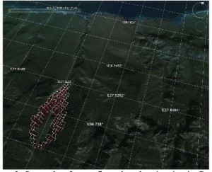
After detecting a wildfire, the main focus should be the estimation of its propagation direction and speed. If the model of the vegetation and other important parameters like wind speed, slope, aspect of the ground surface, etc. are known; the propagation of fire can be estimated. This propagation can then be visualized in any 3D-GIS environment that supports KML files.
