AI‑supported video analytics for heritage fire safety: capabilities, limits, and open questions
From open‑door heritage buildings to wildfire‑exposed archaeological landscapes, AI‑supported video analytics are increasingly promoted as a way to improve a key performance indicator in fire safety: the contraction of response time.
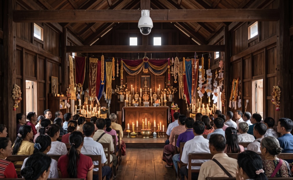
AI‑generated illustrative image representing fire‑risk conditions in a crowded place of worship: combustible decorations, open flames, and video surveillance (VCC/CCTV) monitoring. The scene is synthetic and not a record of a real environment or event.
Building on the earlier description of Greece’s 2026 “AEGIS” (ΑΙΓΙΣ) fire‑protection network for archaeological sites, this post examines how an underlying detection architecture could be actually structured and governed.
Rather than relying on a single detection modality, the system fuses thermal and optical video streams, meteorological data, and geospatial information to generate early, corroborated fire alerts with reduced false‑alarm rates.
This design reflects contemporary best practice in AI‑based fire detection, where sensor fusion and temporal verification are used to distinguish genuine fire signatures from benign heat sources, atmospheric effects, and transient visual phenomena.
Sensor inputs and data streams
At each monitored site, the AEGIS network ingests several complementary data streams:
- Thermal cameras: Long‑wave infrared sensors detect abnormal temperature patterns and hotspots, including incipient flames and smouldering combustion that may not yet be visible in the optical spectrum.
- Optical (visible‑light) cameras: High‑resolution colour cameras provide contextual imagery, enabling operators to visually verify alarms and assess smoke plumes, flame height, and fire spread.
- 360° and PTZ cameras: Rotational and remotely operated units allow systematic scanning of large perimeters and targeted inspection of suspected hotspots.
- Meteorological stations: On‑site sensors record wind speed and direction, temperature, humidity, and related parameters that influence fire behaviour and detection reliability.
- Geospatial reference data: Site maps and asset inventories are integrated into the operator console, linking detected incidents to specific monuments, structures, or vegetation zones.
These inputs are transmitted in real time to regional and coordinating control centres, where they are processed by AI analytics and presented through a unified dashboard.
AI analytics pipeline: detection, tracking, and verification
Public descriptions of the AEGIS system emphasise that it “exploits a combination of data from thermal and optical cameras” and provides real‑time information to fire services.
While detailed algorithmic specifications are not disclosed, the functional requirements and reported behaviour align with established AI fire‑detection architectures that combine spatial, spectral, and temporal analysis. A representative pipeline for such systems includes the following stages:
1. Pre‑processing and enhancement
Raw video frames from thermal and optical sensors undergo pre‑processing to improve signal quality and stabilise detection under varying illumination and atmospheric conditions. Typical operations include:
- Noise reduction and contrast enhancement: Thermal images may be filtered to suppress sensor noise and enhance subtle temperature gradients; optical frames may undergo adaptive gamma correction or histogram equalisation to improve visibility of smoke and flames under low‑light or high‑contrast conditions.
- Geometric calibration: Camera intrinsics and extrinsics are used to map image coordinates to site‑specific reference frames, enabling accurate localisation of detected hotspots on maps and 3D models.
2. Candidate region detection
AI models analyse pre‑processed frames to identify candidate fire or smoke regions based on spectral, textural, and morphological cues:
- Thermal hotspot detection: Algorithms segment regions with elevated temperatures or rapid temperature increases, using thresholds or learned models to distinguish potential fire signatures from warm surfaces (e.g. sun‑heated stone, machinery).
- Optical flame and smoke detection: Convolutional neural networks (e.g. YOLO‑family detectors) or classical computer‑vision methods identify flame‑like colour patterns (red–yellow hues), flicker frequencies, and smoke‑like textures (diffuse, semi‑transparent, upward‑moving regions).
- Multi‑scale analysis: Detectors operate at multiple spatial scales to capture both small, incipient flames and larger, developed fire fronts.
3. Temporal tracking and verification
To reduce false alarms caused by transient phenomena (e.g. vehicle headlights, reflections, dust, clouds), candidate detections are associated into temporal tracks and verified over time:
- Track formation: Detections across consecutive frames are linked using motion models (e.g. Kalman filters, optical flow) to form spatio‑temporal tracklets representing persistent objects or phenomena.
- Spatio‑temporal verification: A secondary network or rule‑based module evaluates each track’s appearance, motion, and evolution. Genuine fires typically exhibit characteristic behaviours such as upward or outward smoke, flickering intensity, and growth over time, whereas false positives (e.g. static reflections, passing vehicles) fail these temporal consistency checks.
- Confidence scoring: Each track is assigned a confidence score reflecting the likelihood of being a true fire or smoke event. Alerts are triggered when scores exceed predefined thresholds or when multiple independent cues converge.
4. Sensor fusion and decision logic
The core innovation of the AEGIS architecture lies in its fusion of heterogeneous sensor data to produce robust, context‑aware alerts:
- Thermal–optical corroboration: A detection is considered more reliable when both thermal and optical modalities indicate a fire‑like signature in the same location and time window. For example, a thermal hotspot coincident with visible smoke or flame in the optical stream receives a higher confidence score than either cue alone.
- Meteorological conditioning: Weather data modulates detection sensitivity and alert prioritisation. High wind speeds, low humidity, and elevated temperatures may lower detection thresholds and elevate alert levels, reflecting increased fire risk and potential spread rates.
- Multi‑camera cross‑verification: Where overlapping camera fields of view exist, detections can be cross‑checked across multiple vantage points to confirm location and reduce occlusion‑related errors.
- Geospatial contextualisation: Detected incidents are mapped onto site layouts, linking alarms to specific archaeological features (e.g. wooden reconstructions, visitor facilities, vegetation zones) and informing resource allocation.
The final alert decision emerges from a weighted combination of these cues, often implemented as a rule‑based expert system or a learned fusion model that balances sensitivity (early detection) against specificity (false‑alarm suppression).
Operator interface and human‑in‑the‑loop verification
Processed information is presented to operators through a map‑based dashboard that integrates:
- Geolocated alarms: Detected hotspots appear as markers on site maps, with timestamps, confidence scores, and associated camera views.
- Live video and thermal feeds: Operators can inspect real‑time optical and thermal streams from fixed and PTZ cameras to visually confirm alarms and assess fire behaviour.
- Equipment status: The interface displays the operational status of cameras, sensors, and suppression assets, enabling rapid troubleshooting and maintenance planning.
Human operators play a critical role in the final verification and response chain. AI analytics reduce the cognitive load by filtering obvious false alarms and highlighting high‑confidence incidents, but operators retain authority to escalate, downgrade, or dismiss alerts based on contextual knowledge and visual inspection.
Confirmed incidents are transmitted in real time to the Hellenic Fire Service, supporting faster dispatch and more precise initial attack planning.
Performance considerations and false‑alarm management
A key challenge in AI‑based fire detection is managing the trade‑off between early detection and false‑alarm rates. In heritage settings, frequent false alarms can erode operator trust and lead to alert fatigue, undermining system effectiveness. The AEGIS architecture addresses this through several mechanisms:
- Multi‑modal corroboration: Requiring agreement between thermal and optical cues significantly reduces false positives caused by non‑fire heat sources or visual artefacts.
- Temporal verification: Analysing the evolution of candidate regions over time filters out transient phenomena that lack fire‑like dynamics.
- Context‑aware thresholds: Adjusting detection sensitivity based on meteorological conditions and site‑specific risk profiles helps maintain high sensitivity during critical periods while avoiding over‑triggering in low‑risk conditions.
The system’s successful detection of a wildfire near Mycenae in July 2026 demonstrates its operational capability to identify incipient fires and trigger timely alerts under real‑world conditions.
Implications for fire‑risk engineering at heritage sites
AI analytics and sensor fusion can enhance fire‑risk management at cultural heritage sites:
- Earlier, more reliable detection: By combining thermal, optical, and meteorological data, the system can identify fires earlier and with greater confidence than single‑modality approaches.
- Reduced false‑alarm burden: Multi‑sensor corroboration and temporal verification lower false‑alarm rates, improving operator trust and long‑term system usability.
- Scalable, modular architecture: The same fusion principles can be applied to additional sites or integrated with broader landscape‑level fire‑detection networks, creating hierarchical systems from local to regional scales.
For engineers and risk managers, the Greek experience underscores the value of designing fire‑detection systems around AI‑driven sensor fusion, where complementary data streams are jointly analysed to produce robust, context‑aware alerts that align with both operational fire‑safety needs and heritage‑conservation constraints.